[:en]
Planning hiking opportunities
The Badlands National Park in South Dakota is one of the few National Parks which covers a large area, but still has only few maintained hiking trails. Looking at the official NPS-Map you just see two longer trails: Castle Trail and Medicine Root Trail. Both are next to each other and they cross several times.
There are six more official trails, but they are all less than a kilometer (0.62 Miles) and all located in the northeast area of the park like the two above. So if you want to hike more, you have to get creative. Since the Park offers so much more that wants to be explored, you have to go into the backcountry on your own.
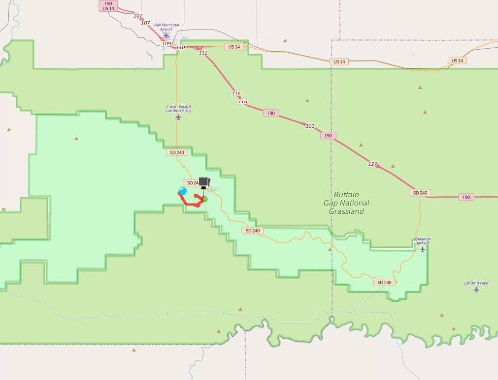
For a two day hike with a night in the tent, I chose a trail from the webpage of the Backpacker-Magazine which leads into the Sage Creek Wilderness. As a 35 km (21.7 Miles) long roundtrip hike trough the hills and the prairie of the Badlands, it should display the beauty to the National Park for hiking enthusiasts. It was planned to spend the night int the grasslands. A wide-open grass-covered area with grazing buffalos. Thankfully, in Badlands National Park you are allowed to stay overnight in the backcountry without a permit. The only twist – no reliable watersource along the trail.
The rule of thumb says to carry 4 liter (1 gal) of water per person. Add to that around a liter (1/4 gal) of water for cooking and the morning coffee. As the result you have to carry around 9 kilos (19.8 lb) of water in addition to the hiking and camping gear. So my backpack weighs about 17 kilos (37.5 lb) – ouch. The plan was to take the two-day hike – but plans are there to be changed. And this fate had to be accepted for this hike. A cold decided to creep up on me, just so see the nice area, too.
Thus I felt very weak the day before the hike and I asked myself how I should carry all the weight all these kilometers in my poor condition. If the trip would have been at the end of my vacation I would have go for it. Since I didn’t want to risk that being sick the rest of the vacation, I reluctantly decided to cut the hike down to a one-day trip. On the bright side it meant to carry less water and no camping gear. And I would hike as far as my feet and my body would take me.
Do you have a GPS-device? Use it!
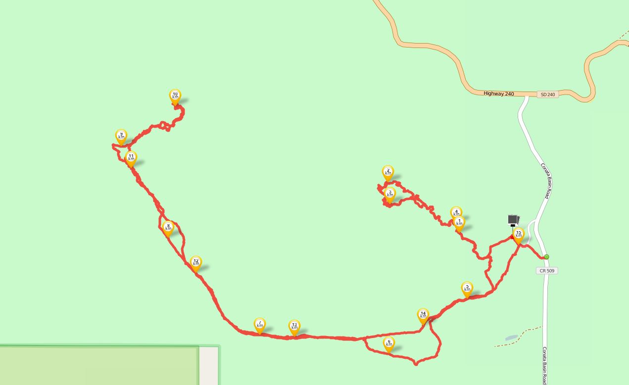
The hike startet at the Conata picnic area at Conata Road (509). Due to construction the access to the picnic area was blocked, but there was a spot to park across the street. Just one car parked there so I didn’t expect much activity on the trail. At the edge of the picnic area was a box imprinted with „backcountry registration“. Inside this box was a list with records of hikers which have been here before. Just two entries per day – a guarantee for solitude. The last entries showed „Deer Haven“ as destination. Since I uploaded the track to my GPS-device, I was able to see that Deer Haven was a waypoint of the originally planned two day hike. Thinking „why not hike there“ I entered Deer Haven as my destination as well. A couple of steps next the the registration box was a sign which warned about rattlesnakes. The probability to encounter rattlesnakes in the high grass land was quite high.
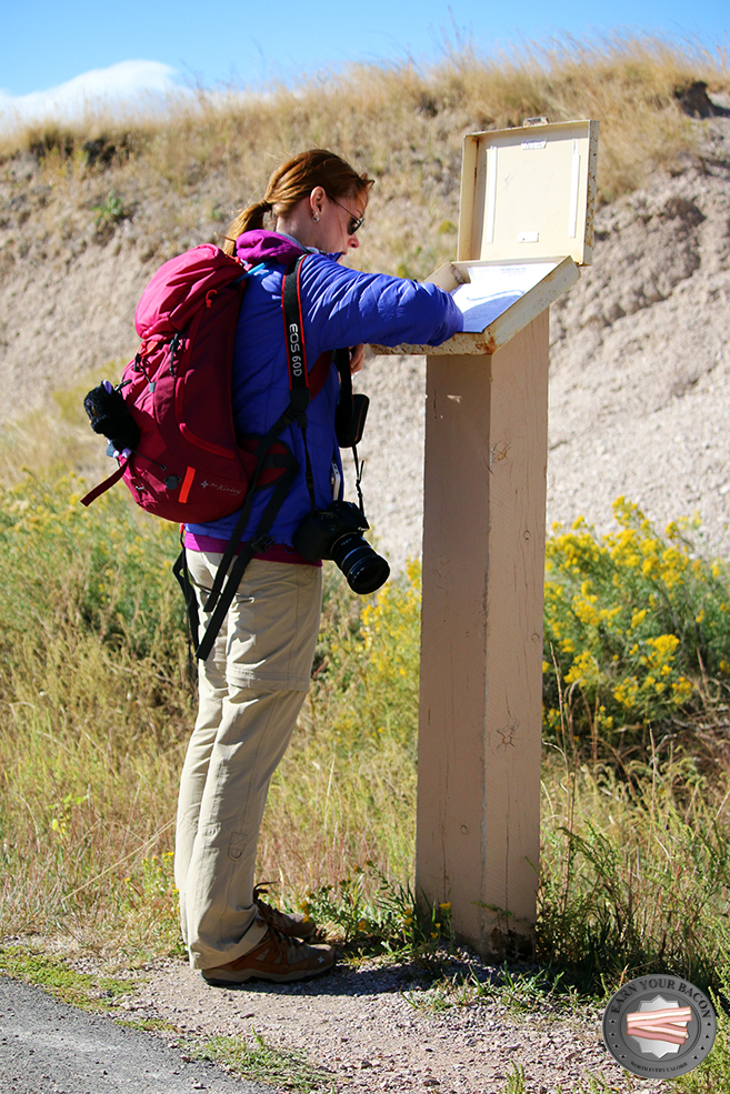
The hike startet at the Conata picnic area at Conata Road (509). Due to construction the access to the picnic area was blocked, but there was a spot to park across the street. Just one car parked there so I didn’t expect much activity on the trail. At the edge of the picnic area was a box imprinted with „backcountry registration“. Inside this box was a list with records of hikers which have been here before. Just two entries per day – a guarantee for solitude. The last entries showed „Deer Haven“ as destination. Since I uploaded the track to my GPS-device, I was able to see that Deer Haven was a waypoint of the originally planned two day hike. Thinking „why not hike there“ I entered Deer Haven as my destination as well. A couple of steps next the the registration box was a sign which warned about rattlesnakes. The probability to encounter rattlesnakes in the high grass land was quite high.
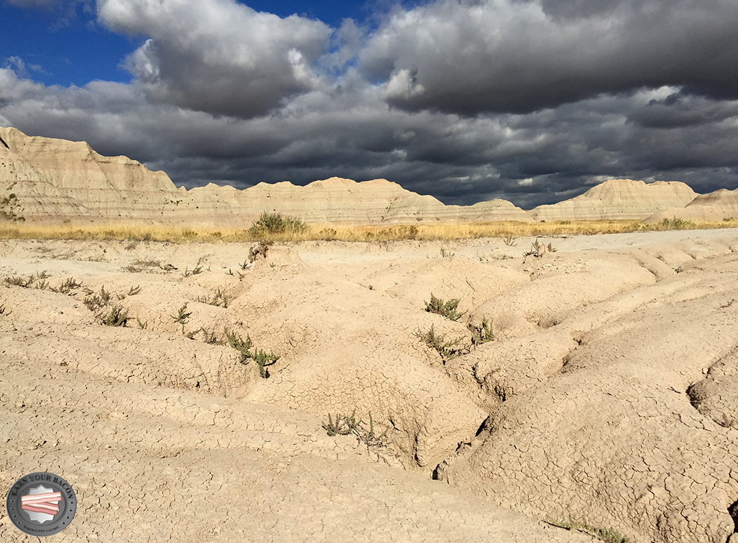
Here we go Badlands! The weather forecast predicted contrary weather with light rain for this September-day. But at the beginning the sun was still shining. I roughly memorized the first part of the track. A little bit straight and then following the dried out riverbed. For this part I left my GPS-device off. The riverbed lead straight to the harsh rocky buttes which are typical for the Badlands. Pastel-colored pinnacles throughout the countryside immersed the area in vanilla and soft pink colors. Being already in the rocky formations all of a sudden the riverbed split – time to check the GPS. A look on it revealed that I should have checked it way sooner. After lots of scrolling on the tiny screen I found the track – ways away from my current location. What next? Return to the point where I left the track? Looking at the digital map, hope rised that I can cut through to the original track, if I take a certain direction. Unfortunately there were lots of buttes in this direction which meant boulder time. A few buttes shouldn’t be a problem, right? At least the overview from the top would help to assess the situation. The sky was slowly getting cloudy and I hoped to get through with climbing before the rain.
Up it goes! Ascending the hills I already realized how loose the top layer was. Crumbly clay, which loosened by every careful step, to slide down the hills. Finally arriving at the top mixed feelings rose in my guts. The view was breathtaking. An endless scenery with hills stretched to the horizon. But it also brought disillusion – it meant that there was no shortcut back to the original track. The only option left was to return to the point where I left the track.
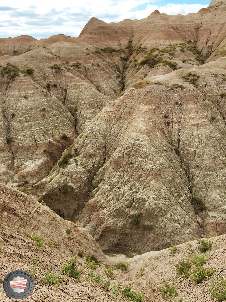
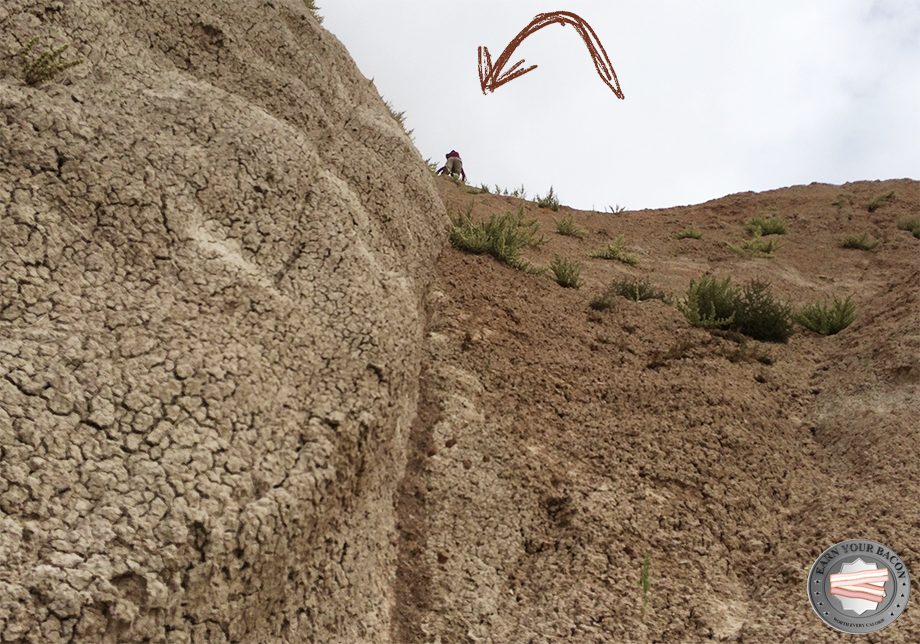
But first I had to get down from this hill. Which turned out to be easier said than done. From up here, things looked a lot steeper than from the bottom. And the loose gravel made things worse. A little aisle looked promising and after a quick examination my partner discovered that one has enough grip by kicking the feet into the clay. He went first and I wanted to follow him. Unfortunately the gravel was so loose that it all slid down while he descended, which left me with a slick slippery surface on the ideal path of the aisle. I tried to climb down next to it, but the clay was so crusted over and thin that my shoes would not hold on to the surface. The tiny shrubs I grasped in despair just pulled out. So I was stuck on the descend, hardly being able to move back or forth. I felt like a cat, being stuck and meowing terrified, after climbing on a tree.
My legs started to tremble and my steps got more and more shaky. Every move set off a little avalanche of gravel underneath me. Just a few feet to move down but a few feet to much for me in this strenuous situation. Inch by inch I crawled downward and the grip underneath my shoes got worse. And then it happened – one foot slipped, and then the other one. My fingers tried to grasp into the clay but no chance – I kept sliding till my partner caught and stopped me. Luckily we escaped with no more than a scare and some scratches. And I swore to myself not to do such a crazy thing again. And to check with the GPS even if I think that I know exactly where I am.
Back on track
Getting lost took about 1.5 miles, more than 2 hours and some nerves. But we got directly into the Badlands formations. Always think positive.
Back on track I now strictly followed my GPS-device. First, it led me over wide plains with few vegetation. Then all of a sudden, the grass was getting higher and higher. The sky darkened. Wind and storm began and rain was following soon. Just a tiny glance and the decision was made: a real hiker continuous his way. Hardshell-jacket put on, rain cover over the backpack, camera put away. On with the show! A tiny caved path led the way for a while, but more often I had to rely on my digital map when no way was visible due to the high grass. Grass, where you just have to trust that you won’t set foot on a rattlesnake.
After traversing a large flat with white sand, that in former times must have been a mighty river, Deer Haven leapt into view. One of the few larger tree covered areas in the Badlands.

To get to Deer Haven I had to ascend the badlands formations once again. This time though I was following my GPS device, which showed a pretty easy way up. Arriving there, the grass was tall enough to reach my knees and I was finding myself in a little wood of juniper. Juniper that does not look similar to the European juniper in any way. The European juniper has luscious green and is really bushy. The juniper in the Badlands are more like dry bizarre tree creatures that bend in the landscape.
For an even more terrific view, I had to get out of this wood and ascend a little further. Impracticable, that might be the word that fits this passage best. First, I had to find a gap where it was possible to get on top of the harsh rim. When I found a suitable spot and began to climb up, I recognized the tiny stones sliding under my feet again. This way back should be funny.
The gorgeous view from up there was worth all the effort. On the horizon you could see some cows. The rest was Badlands formations, pinnacles, buttes and prairie, the trees of Deer Haven right below me. The sun had fought its way back through the clouds and the sky had become light blue.
Since it was pretty late already, this had to be the farthest point to reach today and to avoid returning in darkness. Nearly an hour to relax and eat some trail mix and energy bars as a reward. Before starting to hike back, I just had to look out for the passage that could have been my way for the 2-day-trip. It should have been a great adventure.
The descent was as challenging as expected. Everything below my feet was moving faster than I wanted it to and I tried not to start rolling myself down the hill. I started quite well, but when it got to steep, I decided just to let go and threw myself in the branches of a large tree. I love nature!
The way back was quite relaxing. Beautiful contrasts accompanied the 6.5 mile -walk with dark blue clouds darkening the sky while the sun had let the badlands formations be lighted up.
Without snakebites or any other injuries I arrived pretty satisfied at the rental car after six adventurous hours and 9.5 miles. Tired, but satisfied. Since I could not spend the night in the wilderness, I was happy that I found the Sage Creek campground on the park map. When I arrived there at sunset, buffalos where grazing there and I could hear the coyote howl at night. Not too bad for a Plan B!
[:de]
Galerie oben zum Durchklicken
Die Planung – Wandermöglichkeiten erschließen
Der Badlands Nationalpark in South Dakota ist einer der wenigen Nationalparks, der zwar flächenmäßig sehr groß ist, aber nur sehr wenig ausgewiesene Wanderwege, hier genannt Trails, bietet. Schaut man auf die offizielle, vom Nationalpark-Service ausgegebene Karte, gibt es nur zwei längere: den Castle Trail und den Medicine Root Trail.
Beide liegen direkt nebeneinander und überschneiden sich an einigen Punkten sogar. Die sechs weiteren Trails sind meist weit kürzer als einen Kilometer und im selben Umkreis wie die vorgenannten – im Nordosten des Parks. Wer mehr will, muss also kreativ werden.
Da der Park so viel mehr bietet und erkundet werden will, kann man auf eigene Faust das Hinterland, das in Nationalparks als Backcountry bezeichnet wird, erkunden. Für eine zweitägige Wandertour mit Zwischenübernachtung im Zelt hatte ich mir über Blogs und die Seite des Backpacker-Magazins eine Route ausgesucht, die in die sogenannte Sage Creek Wilderness führt. 35 km lang sollte die Rundtour durch die Berge der Badlands und Prärie die Schönheit des Nationalparks für Wanderwütige präsentieren. Als Übernachtungsmöglichkeit waren die Grasslands vorgesehen. Weite Grasflächen, auf denen morgens und abends die Büffel grasen. Ein in vielen anderen Nationalparks notwendiges Permit, eine Erlaubnis zur Übernachtung, braucht es in den Badlands nicht. Vorausgesetzt wird nur, dass man nicht in Sichtweite von Wanderwegen campt. Einziger Haken: es gibt auf dieser Tour keine verlässliche Wasserquelle. Flüsse und Bäche in dieser Gegend führen so sedimentreiches Wasser, dass es nicht trink- oder filterbar ist. Der Filter würde in kürzester Zeit verstopfen.
Für eine Tageswanderung sollte man pro Person etwa 4 Liter Wasser einplanen. Dazu kommt das Wasser, welches man für die Zubereitung (warmer) Speisen benötigt, also etwa 1 Liter pro Tag. Für die Zwei-Tages-Tour muss man also etwa 9 Liter Wasser mitschleppen. 9 Kilo für Wasser zusätzlich zur kompletten Wander- und Campingausrüstung. Meine groben Überschlagungen ergaben ein ungefähres Gesamtgewicht von 17 Kilo in meinem Rucksack. Uff! So der Plan.
Nun sind Pläne grundsätzlich da, um geändert zu werden. Und dieses Schicksal traf auch die Badlandstour. Eine Erkältung hatte sich pünktlich zu Urlaubsbeginn gedacht, sie wolle auch mal die schöne Gegend sehen und mich als ihren Wirt auserkoren. Entsprechend schlapp fühlte ich mich einen Tag vor der Tour und fragte mich, wie ich in diesem Zustand die vielen Kilos über soviele Kilometer schleppen sollte. Wäre dieser Trip am Ende des Urlaubs gestanden, hätte ich es vermutlich trotzdem versucht. Da ich aber nicht riskieren wollte, den Rest der Reise in der Horizontalen zu verbringen, wurde schweren Herzens die Entscheidung gefällt, aus dem Zwei-Tages-Trip nur einen zu machen. Das hieß, es war weniger Wasser zu tragen und statt kompletter Campingausrüstung nur Tagesbedarf. Und gewandert würde werden, so weit die Füße und der restliche Körper eben mitmachen.
Hast Du ein GPS-Gerät? Nutze es!
Startpunkt für die Tour blieb der Conata-Rastplatz an der Conata Road (509). Wegen Bauarbeiten war die Zufahrt zum Rastplatz gesperrt, man konnte aber ganz in der Nähe parken. Nur ein einziges Auto parkte zum Startzeitpunkt auch dort. Es war also nicht viel Betrieb zu erwarten. Auf dem Rastplatz selbst stand eine Box mit der Aufschrift „Backcountry Registration“. Eine Liste fand ich darin mit Eintragungen von Wanderern, die sich zuvor auf den Weg gemacht hatten. Pro Tag waren maximal zwei Einträge verzeichnet, quasi eine Garantie für Einsamkeit. Alle letzten Eintragungen zeichneten „Deer Haven“ als Zielpunkt der Wanderung aus. Die geplante Zwei-Tages-Route hatte ich mir zuvor auf mein GPS-Gerät geladen und konnte sehen, dass Deer Haven ein Wegpunkt darauf war. Warum nicht? Ich trug also ebenfalls Deer Haven ein. Keine zwei Meter nach der Registrierungsbox warnte ein Schild vor Klapperschlangen. In dem grasigen Gebiet war die Wahrscheinlichkeit, auf Schlangen zu treffen, gar nicht mal gering.
Auf ging es in die Badlands. Das Wetter war für diesen September-Tag als durchwachsen mit Regen angesagt. Noch schien zumindest die Sonne. Den ersten Teil der Route hatte ich mir grob eingeprägt. Ein wenig geradeaus und dann dem ausgetrockneten Flussbett folgen. Solange konnte ich mein GPS-Gerät ja ausgeschaltet lassen. Das Flussbett führte geradewegs Richtung der schroffen Hügellandschaft, die die Badlands ausmacht. Spitzkuppen in Pastelltönen ziehen sich kilometerweit durch das Land und tauchen es in Vanillegelb und zartes Rosa. Schon inmitten der Hügel angekommen, teilte sich auf einmal das Flussbett. Zeit, mal auf das GPS zu schauen. Der Blick darauf offenbartem, dass es weit früher an der Zeit gewesen wäre, zu checken, ob der Kurs noch stimmt. Nach einigem Scrollen auf dem winzigen Bildschirm fand ich die Route… und ich befand mich gerade ganz weit weg davon.
Was nun? Umkehren und zum Punkt zurück, an dem ich vom Kurs abgewichen war? Die digitale Karte ließ mich hoffen, dass wenn ich eine bestimmte Richtung einschlage, ich wieder auf der Route lande. Nur lagen in dieser Richtung Hügel. Klettern also. So ein paar Hügel sollten doch nicht das Problem sein. Zumindest wäre ein Überblick von dort oben zum Einschätzen der Lage hilfreich. Der Himmel zog sich langsam zu, aber ich hoffte, die Kletterpartie vor Eintreffen der Schlechtwetterfront hinter mich bringen zu können.
Hoch ging es! Beim Hochklettern merkte ich bereits, wie porös die Schicht war, die die Hügelkette bedeckte. Krümeligster Lehm, der beim sich beim bloßen Drauftreten löste und nach unten abrutschte. Oben angekommen ergab sich ein Bild, das gemischte Gefühle bei mir auslöste. Die Aussicht war atemberaubend. Eine endlose Hügellandschaft, die sich bis über den Horizont erstreckte, aber gleichzeitig Ernüchterung brachte. Hierüber führte keine Abkürzung zurück zur Route. Es blieb demnach nur, zum Punkt des Abweichens zurück zu gehen.
 Aber erstmal musste ich wieder von diesem Hügel herunterkommen. Leichter gesagt als getan. Von oben sahen die Dinge doch ganz anders und viel steiler aus. Und dass die Oberfläche einfach unter den Füßen wegrutschte, half nicht wirklich weiter. Eine kleine Schneise sah vielversprechend aus und nach einem kurzen Test stellte mein Lebenspartner fest, dass man den Schuh in den bröckeligen Lehm stoßen und so Halt bekommen konnte. Er ging vor, ich wollte nachfolgen. Nachdem er unten angekommen war, versuchte ich mich an den ersten Metern. Leider hatte er bei seinem Abstieg die Schneise komplett von Lehm geräumt, so dass an der ideal Stelle nur noch eine blanke, rutschige Oberfläche war. Ich versuchte daher ein wenig neben der Schneise herunter zu klettern. Der Lehm war hier jedoch so verharrscht und dünn, dass ich meine Schuhe nicht richtig hinein stecken konnte. Alles rollte und rutschte unter mir. Die kleinen Büschchen, die ich in meiner Verzweiflung griff, rissen einfach aus. Ich klebte also dort oben am Hügel, konnte weder vor noch zurück. Wie eine Katze, die auf den Baum geklettert war und jetzt heulend dort oben saß.
 Meine Beine fingen an zu zittern und jeder Tritt wurde unsicherer. Mit jeder Bewegung ging eine kleine Steinlawine unter mir ab. Es waren eigentlich nur ein paar Meter. Für mich ein paar zuviel in dieser Situation. Zentimeter für Zentimeter krebste ich zittern weiter, aber der Grip unter meinen Füßen wurde immer schlechter. Irgendwann passierte, was passieren musste. Ein Fuß rutschte, der andere hinterher. Meine Hände versuchten sich ins Gestein zu krallen und so sahen sie nach den Metern, die ich einfach nur noch hinab purzelte, auch aus. Mit einem gehörigen Schrecken, aber weitestgehend unversehrt kam ich unten an. Und schwor mir, das nicht wieder zu tun. Und mein GPS-Gerät zu nutzen, auch wenn ich denke, genau zu wissen, wo ich bin.
Zurück zum eigentlichen Weg
Etwa 3 km, über zwei Stunden Zeit und einige Nerven hatte das Verlaufen gekostet. Aber so waren wir immerhin direkt in und auf den Badlands gelandet. Immer positiv denken.
Zurück auf Kurs folgte ich nun strikt meinem GPS. Das führte erst über fast unbewachsene Flächen und auf einmal wurde das Gras höher und höher und der Himmel fast schwarz. Wind und Sturm legten los und der einsetzende Regen gab sein übriges dazu. Ein kurzer Blick und es war klar: das hält doch einen Wanderer nicht auf. Hardshell-Jacke an, Regenhülle über den Rucksack, Fotoapparat verstaut. Weiter. Ein ausgetretener Pfad wies an vielen Stellen den Weg. An anderen folgte ich nur noch der digitalen Karte, wenn der Weg vor lauter Gras nicht erkennbar war. Gras, bei dem man bei jedem Schritt darauf hoffen musste, den Fuß nicht auf eine Klapperschlange zu setzen. Nach der Überquerung einer großen, weißsandigen Ebene, die vor Ewigkeiten wohl einmal ein mächtiger Fluss gewesen war, kam Deer Haven in Sichtweite. Einer der wenigen Orte in den Badlands, in denen größere Baumbestände zu finden sind.

Um nach Deer Haven zu gelangen, musste ich auf ein neues die Badlands-Formationen erklimmen. Doch diesmal folgte ich ja brav dem GPS, welches einen bequemen Weg hinauf zeigte. Oben angekommen war das Gras knietief und ich stand in einem Wäldchen aus Wacholder. Wacholder, der hier völlig anders aussieht als im gemäßigten Europa. Wohingegen der europäische Wacholder satt, grün und buschig daherkommt, sind die hiesigen Bestände mittelgroße, trockene, sich krümmende bizarre Baumgestalten. Für einen grandiosen Überblick über die Prärie ging es noch ein Stück höher, hinaus aus dem Wäldchen. Unwegsam, so würde ich den kleinen Abschnitt hinauf am ehesten bezeichnen. An der schroffen Kante, die erklommen werden wollte, musste erst einmal ein Punkt ausgemacht werden, der einen Aufstieg ermöglichte. Nachdem ich diesen gefunden hatte und mich ans Klettern begab, merkte ich schon wieder, wie die Steine unter mir wegrutschten. Egal. Über den Rückweg würde ich mir später Gedanken machen.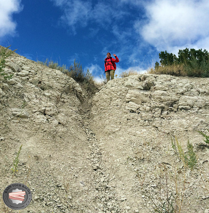
Alle Mühen wurden durch den wunderschönen Ausblick von dort oben belohnt. In ganz weiter Ferne konnte man eine Herde Kühe ausmachen. Ansonsten gab es nur die Badlands-Formationen und Prärie, unter mir die Bäume von Deer Haven. Den Rest füllte der inzwischen wieder blaue, von ein paar hellen Wolken geschmückte Himmel aus.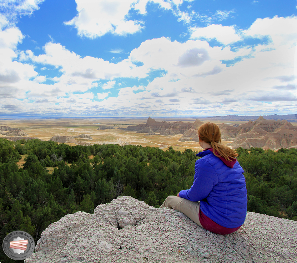
Da die Zeit schon recht weit voran geschritten war, sollte dies der weiteste Punkt an diesem eintägigen Trip sein, den man noch erreichen konnte, ohne im Dunkeln zurück gehen zu müssen. Eine knappe dreiviertel Stunde Pause, Trail Mix und Energieriegel gab es zur Stärkung und als Belohnung. Vor dem Antritt des Rückwegs konnte ich aber nicht darauf verzichten, noch einen sehnsüchtigen Blick in die Richtung zu werfen, in die es eigentlich auf der Zwei-Tages-Tour noch hätte weitergehen sollen. Es wäre sicher ein tolles Abenteuer geworden.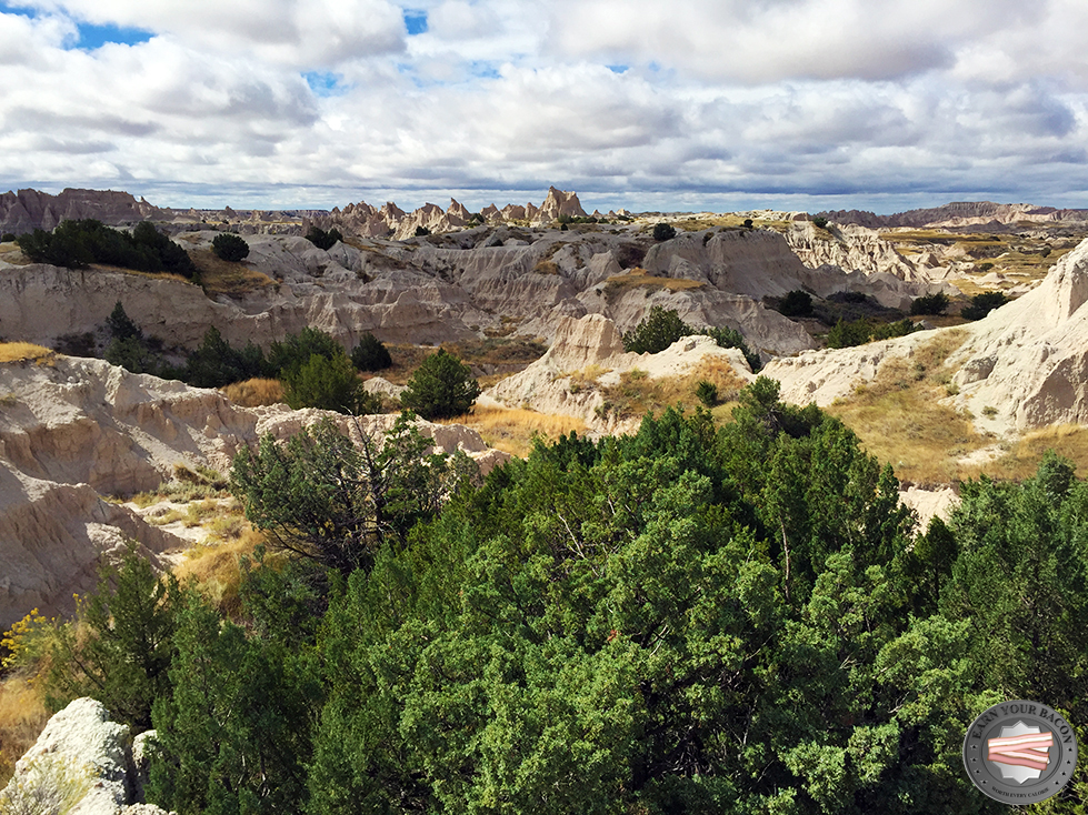
Der Abstieg war erwartet interessant. Alles bewegte sich unter meinen Füßen schneller als mir lieb war. Ich versuchte erneut, nicht selbst wie die Steinchen unter mir ins Rollen zu geraten. Das gelang mir diesmal auch ganz gut. Als es doch ein wenig zu steil und rutschig wurde, ließ ich mich einfach in die Äste eines Baumes fallen. Ich mag Natur!
Der Rückweg verlief zur Abwechslung unspektakulär. Das Wetter zeigte noch einmal, welch herrliche Kontraste es hervorbringen konnte: dunkelblaue bis tiefgraue Wolken verdunkelten den Himmel, während die Sonne von der anderen Seite die Formationen hell erstrahlen ließ.
Ohne Schlangenbisse oder sonstige Blessuren kam ich zufrieden nach guten sechs Stunden und 15 km wieder am Auto an. Erschöpft, aber zufrieden. Als kleinen Ausgleich für den Verzicht auf die Übernachtung in der Wilderness hatte ich den primitiven Sage Creek Campground auf der Karte entdeckt, an dem bei Ankunft kurz nach Sonnenuntergang tatsächlich Bisons grasten und in der Nacht die Kojoten heulten. Für einen Plan B nicht schlecht!
