[:en]Nobody said it would be easy. It would have been a lie anyway.
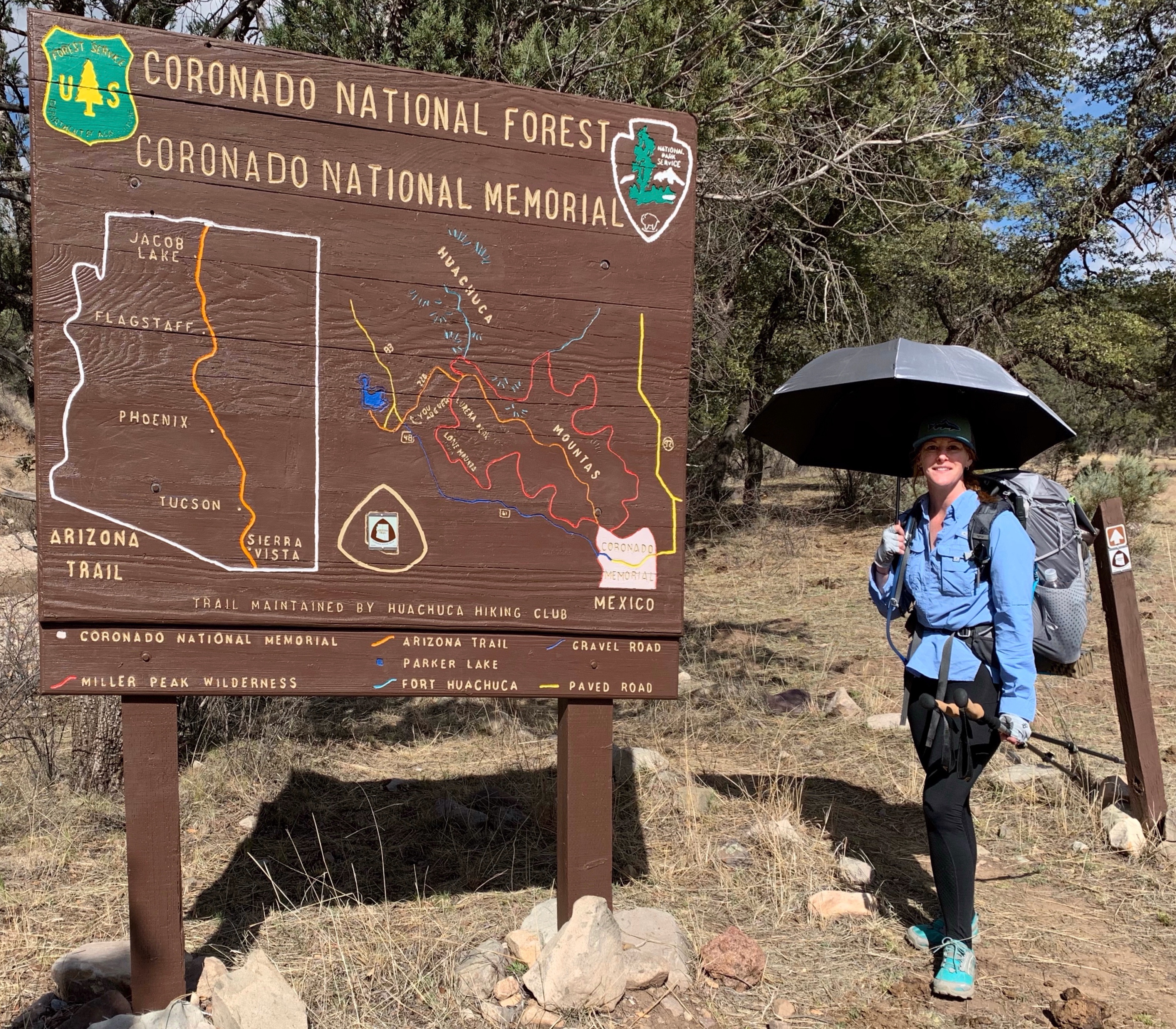
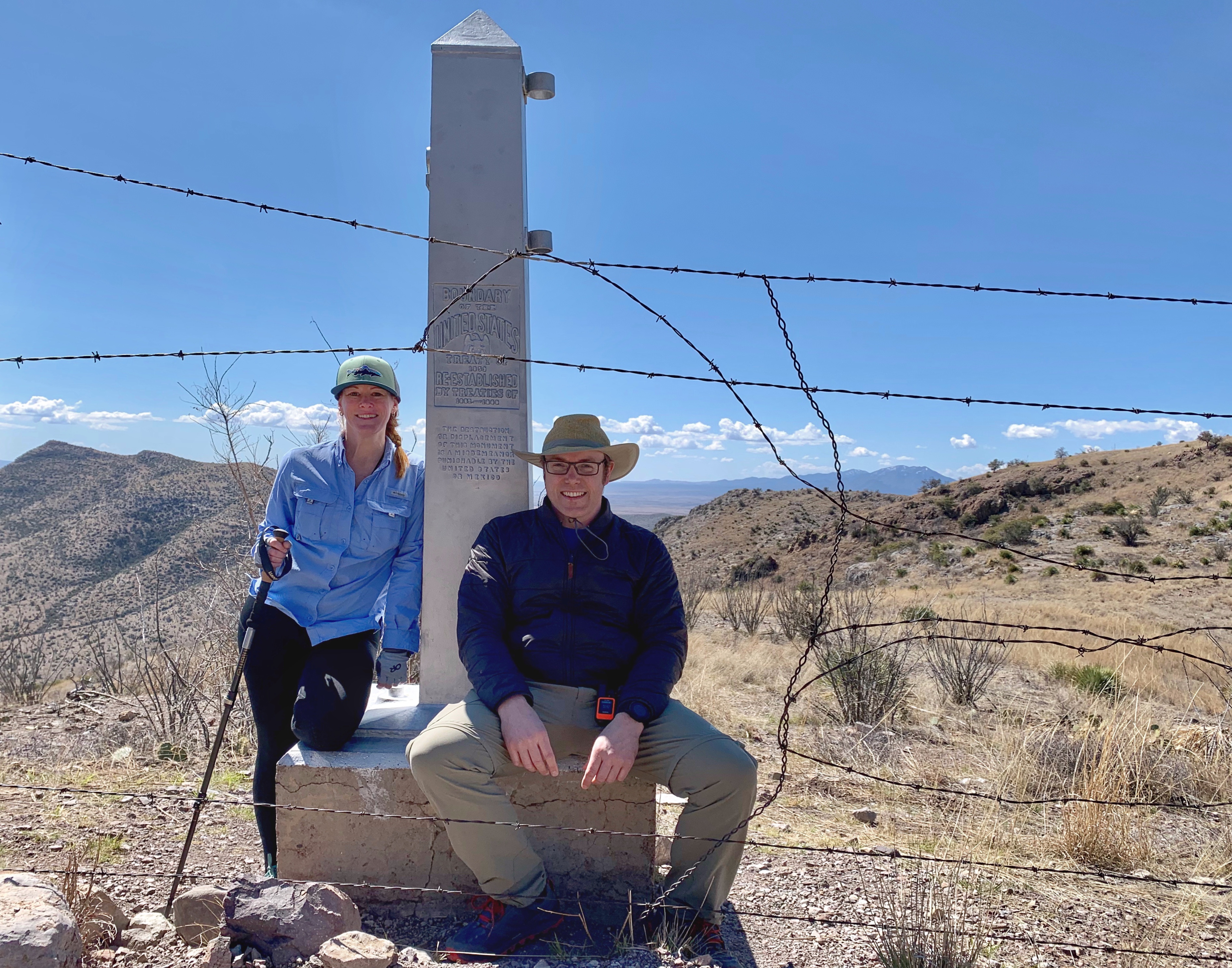
In the middle of March , two nice trail angels are dropping us off at Montezuma Pass, the closest location to the Mexican border that you can reach by car. It is four ambitious hikers that start today: the American Rand, the Swedish girl Emilie and us Germans. From Montezuma Pass, we have to hike around two miles to the southern terminus… and back again. After quite a long photo stop there, taking pictures in front and behind the barbed wire that separates the US from Mexico, our ways already part. Well, at least Rand is running far ahead.
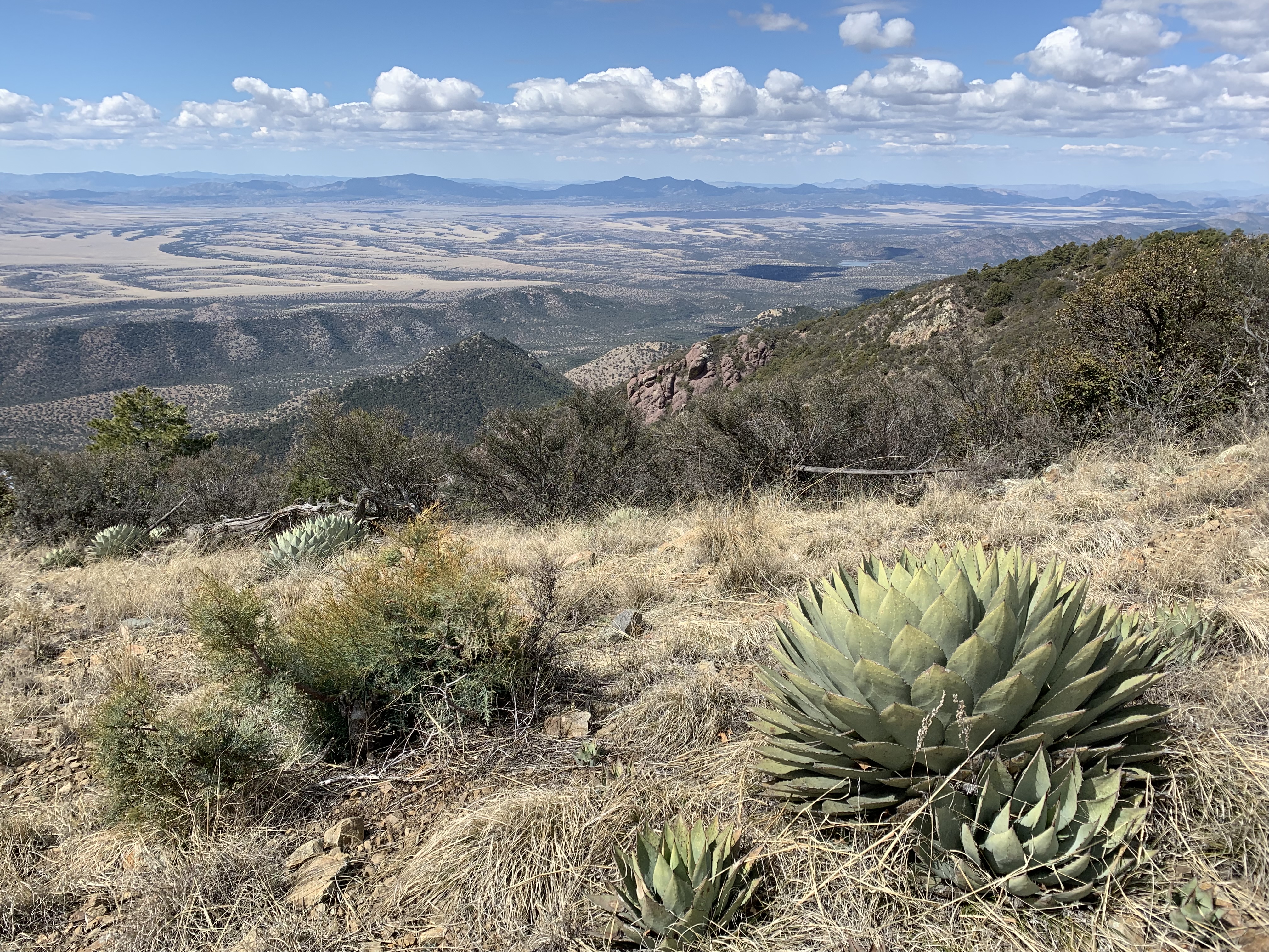
Passage 1 of 43 is one of the hardest, since you have to climb up the Huachuca Mountains from the very beginning. 3.900 feet over 11 miles. We have to sweat a lot more from climbing than from the burning sun while the three of us are crawling around the endless switchbacks. Our goal for today is Bathtub Spring, where fresh spring water is flowing into an old bathtub.
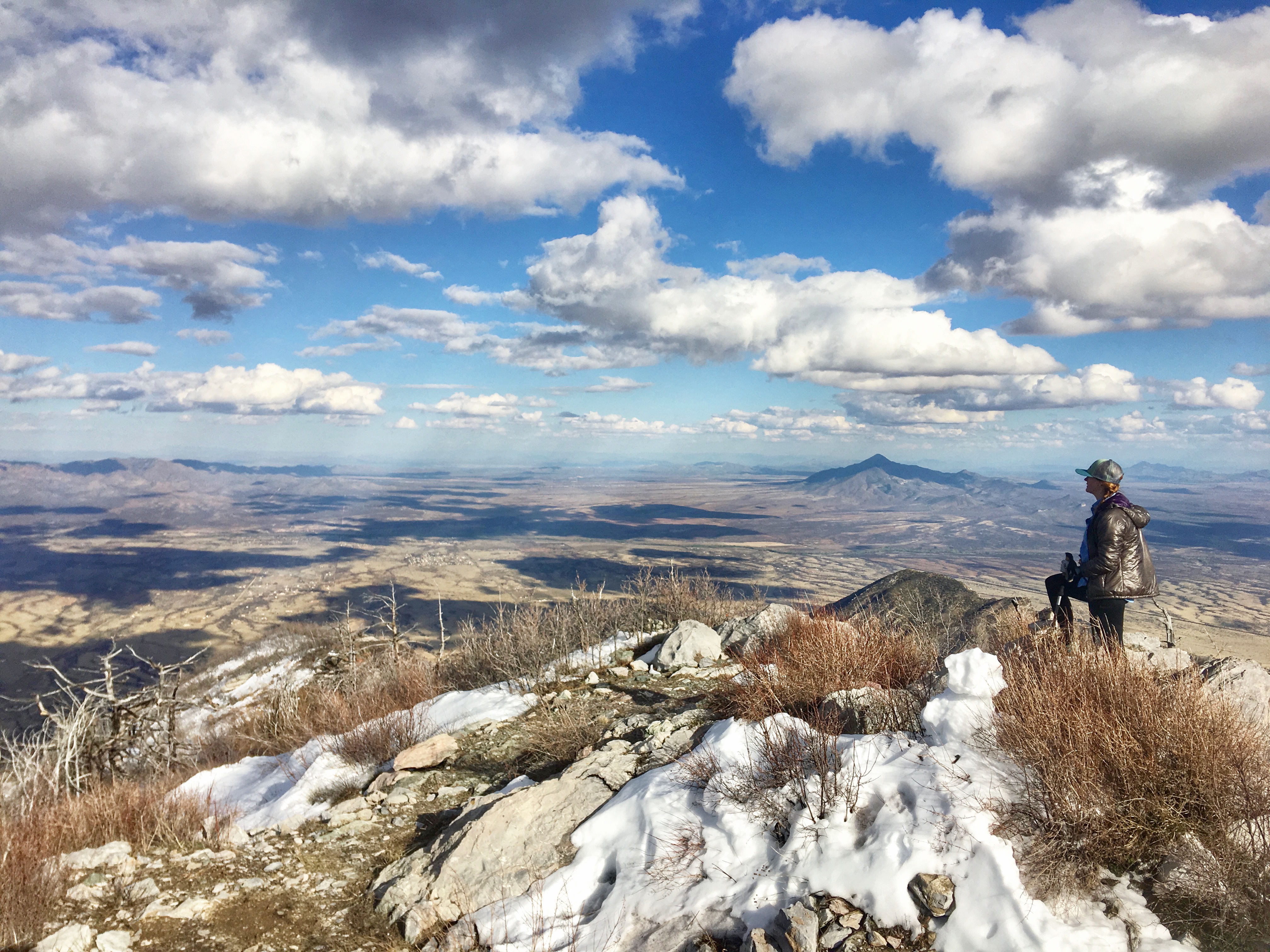
Emilie wants to do the whole thruhike in only 25 days, covering 35 miles every single day without a zeroday. Looking at the terrain,that seems impossible to me. I am taking it slow, starting with 16 miles a day. As the miles go by, Emilie is feeling more and more sick. She even skips the short climb up Miller Peak What a pity, it is a fantastic view from up there.
Right on the trail, we find a plastic bag with hiking clothes and a sleeping pad, wondering, who might have lost or left it there. It is already 5:30 pm when a huge snowfield covers the Arizona Trail and slows us down again. It is dangerous and strenuous. We reach Bathtub Spring right at sunset. Since we are tired as hell, we pitch our tents as fast as possible, eat and sleep. We are already in thruhiker mode.


What goes up, must come down again
The next morning, the Border Patrol checks us out by helicopter while we prepare our breakfast. Emilie has already left, because she still has a long way to go today. At 9 o’clock the slow descent begins and allows gigantic views over Arizona and Mexico. Due to the heavy rain and snowfall, the riverbed in the picturesque Sunnyside Canyon is flowing with crystal-clear meltwater. We filter anyway, you never know if there is a dead animal lying around upstream.
I walk a few steps and hear it rustling. Then I look at the coati strolling in the forest. Such an animal can be seen only in the Berlin zoo! After we leave the forest, the grasslands await us, without any shade. For the first time I use my umbrella, which provides little shade. Underneath, it is still very hot. The Border Patrol checks us out again, this time from the car. We do not seem to look very Mexican. The first cows appear on the trail.


After 13 miles today, we complete the first passage of the AZT, still about 3 miles left to the planned camp spot. It is strenuous again, but the prospect of a hot meal and sleeping bag are pushing ahead. I hear the small stream rippling and right next to it is an idyllic place for the tent.
The Hills of Death
Day 3 leads through the Canelo Hills. A harmless altitude profile in contrast to the first day, I think. What I have not considered: three times up and down is at least as bad as a steady climb. The sun is blasting from the sky and the two liters of water with which I started are already drunk before reaching the next water source. We are incredibly happy about the fact that water flows here in the middle of the desert. Last year, there was only one flowing river in southern Arizona. The stream is not flowing very fast, but it is sufficient. The comments in Guthook from the hikers who were here a few days before me are really helpful. I take a small amount of water without filtering and hope to be able to exchange it for public gallon water at the next trailhead.


But there is no public water at the trailhead. All I find is a half-empty gallon of a hiker, which is declared public only from tomorrow. Therefore, the decision to walk another 4 miles to the next water source is easy. But my feet hurt and I’m tired. Fortunately, there is only a climb over one mountain saddle, then it should be downhill to a pond, from which a dozen cows are drinking. I don’t care about the slalom around cow dung, as well as the fact, that I have to set up camp next to it. The important thing is to get water for my meal, the shoes off my feet and some decent sleep. I wonder how Emilie is dealing with 35 miles a day…


Civilisation
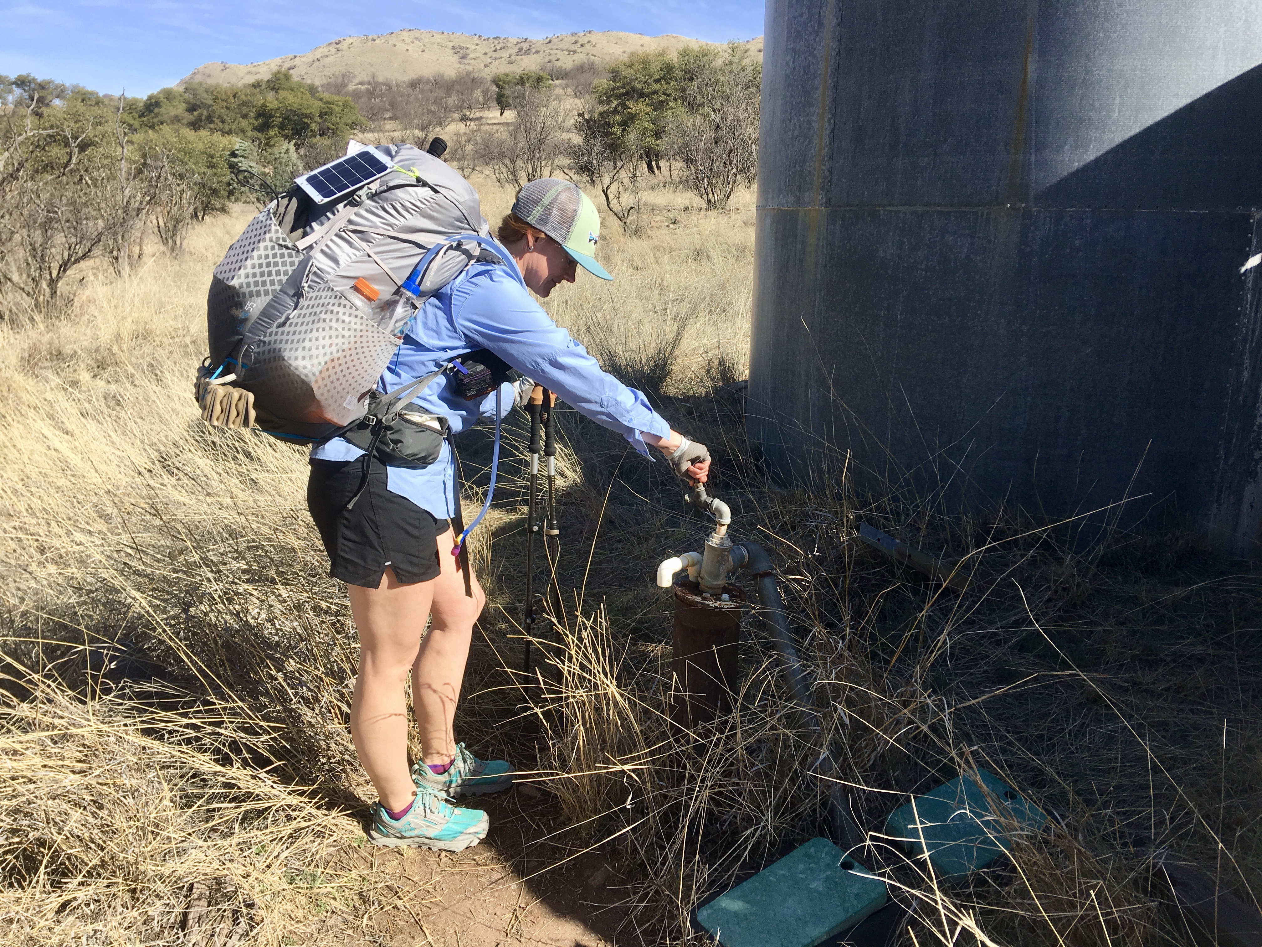
At 6 am, a howling pack of coyotes wakes me from far away. Time to get up. It is one of those rare moments when the super moon can still be seen on the horizon in the west, while the sun is already rising in the east. The trail is merciful today. There is a lot of downhill, little uphill and there is plenty of water from large metal tanks.
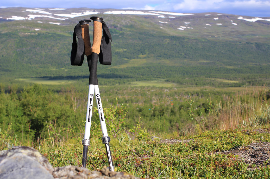
My feet can stand less miles every day before they begin to hurt. There is no trail with more rocks than the Arizona Trail. Above all, the loose rocks make my ankles twist again and again. More than once, my trekking poles save me from falling.
At 3 pm we reach today’s destination, the small town of Patagonia. The last 3 miles roadwalk have worked hard on my feet and it is difficult to cover the few yards from the pizza place to the trailer where I will spend a day without trail miles tomorrow. My body needs regeneration. From Emilie, I receive the news that she left Patagonia this the morning.


– Continue with Part 2 –
[:de]Niemand hat gesagt, das wird leicht. Und es wäre auch gelogen. Ein gesundes Maß an Planung und gesundem Menschenverstand machen aber doch vieles einfacher.
Zwei nette Trail Angel fahren uns zu viert am Montag morgen zum Montezuma Pass, dem nächstgelegenen und mit Auto erreichbaren Ort zum Start des Arizona Trail an der mexikanischen Grenze. Wir vier, das sind der Amerikaner Rand, die Schwedin Emilie und wir zwei Deutschen. Drei Kilometer sind es runter bis zum Grenzstein, die wir auch auf demselben Weg wieder zurück müssen. Nach einer ausgiebigen Fotosession hinter und vor dem Grenzzaun, der hier nur aus Stacheldraht besteht (noch!), trennen sich die ersten Wege und Rand zieht von dannen.
Passage 1 von 43 ist eine der härtesten, denn es geht den ganzen Tag nur bergauf. Rund 1.300 Höhenmeter warten über 18 km darauf, von uns bezwungen zu werden. Der Anstieg wärmt uns mehr auf als die Sonne, während wir zu dritt Haarnadelkurve um Haarnadelkurve die Huachuca-Mountains hinaufkriechen. Bathtub Spring ist das heutige Ziel, ein kleine Quelle, die in eine alte Badewanne fließt. Emilie möchte den Trail in 25 Tagen machen und damit 50 km pro Tag gehen. Das ist für mich in dem Terrain unvorstellbar. Ich plane rund die Hälfte pro Tag. Ich will Arizona schließlich genießen. Im Laufe des Tages geht es ihr aber immer schlechter, so dass sie sogar den Schlenker hoch zum Gipfel der Miller Peak auslässt.
Auf dem Trail finden wir einen Plastikbeutel mit Wandersachen und eine Isomatte und fragen uns, was wohl die Geschichte dazu ist. Um 17:30 Uhr hoffen wir alle, endlich an der Quelle anzukommen, aber ein Schneefeld macht das Vorankommen langsam, gefährlich und furchtbar anstrengend. Als wir um 18:30 Uhr pünktlich zum Sonnenuntergang ankommen, werden schnell die Zelte aufgebaut, mühsam Feuer fürs Essen gemacht und um 20 Uhr ist Ruhe im Karton.

Was hoch geht, kommt auch runter
Am nächsten Morgen checkt uns die Border Patrol, der Grenzschutz, per Helikopter aus, während wir unser Frühstück zubereiten. Emilie zieht von dannen, denn sie hat ja noch eine ganze Strecke vor sich. Um 9 Uhr beginnt für uns der langsame Abstieg, der auch immer mal gern wieder nach oben führt und gigantische Blicke über Arizona und bis rüber nach Mexiko ermöglicht. Durch die heftigen Regen- und Schneefälle führt das Flussbett im malerischen Sunnyside Canyon glasklares Schmelzwasser. Gefiltert wird trotzdem, man weiß ja nie, ob nicht irgendwo ein totes Tier herumliegt.
Ich gehe ein paar Schritte und höre es rascheln. Da guckt mich ein Coati, eine Art Nasenbär aus dem Wald an. So ein Tierchen sieht man sonst nur im heimischen Zoo! Nachdem wir den Wald verlassen haben, geht es hinaus ins Flachland, ohne ein bisschen Schatten. Ich nutze zum ersten Mal meinen Schirm, der ein wenig Schatten spendet. Darunter ist es trotzdem brütend heiß. Die Border Patrol checkt uns ein weiteres Mal aus, diesmal vom Auto aus. Sonderlich mexikanisch scheinen wir nicht auszusehen. Die ersten Kühe tauchen am Trail auf.

Nach 21 km am heutigen Tage ist die erste Passage des AZT erreicht, noch rund 4 km bis zum geplanten Campspot. Sie fallen schwer, aber die Aussicht auf ein warmes Tütenmahl und Schlafsack treiben voran. Schon kurz vor dem Ziel höre ich den kleinen Bach plätschern und direkt nebenan findet sich ein idyllischer Platz fürs Zelt.
Die Hügel des Todes
Tag 3 führt durch die Canelo Hills. Ein harmloses Höhenprofil im Gegensatz zum ersten Tag, denke ich. Was ich aber nicht bedacht habe: dreimal hoch und runter ist mindestens genauso schlimm wie einmal am Stück hoch. Die Sonne brettert vom Himmel und die zwei Liter Wasser, mit denen ich gestartet bin, sind bis zum nächsten Auffüllpunkt ausgetrunken. Dass hier im Middle Canyon überhaupt Wasser fließt, ist ein unglaubliches Glück. Im letzten Jahr führte im gesamten Süden Arizonas nur ein einziger Fluss Wasser. Viel ist es hier zwar nicht, aber ausreichend. Die Kommentare der Wanderer, die einige Tage vor mir hier waren, sind wahnsinnig hilfreich. Ein wenig Wasser nehme ich ungefiltert mit und hoffe, es gegen öffentlich bereitgestelltes Wasser am nächsten Trailhead tauschen zu können.
Die Hoffnung erfüllt sich leider nicht. Hier steht nur eine halbleere Gallone eines Hikers, die erst ab morgen für öffentlich erklärt ist. Damit ist auch die Entscheidung, noch 5,6 km weiter zur nächsten Wasserquelle zu wandern, getroffen. Die Füße tun mir weh und ich bin müde. Glücklicherweise folgt nur noch ein Anstieg über ein Bergsattel, danach geht es runter zu einem Tümpel, aus dem sich ein Dutzend Kühe bedient. Der Slalom um Kuhfladen herum ist mir wurscht, ebenso die Tatsache, quasi daneben zu zelten. Hauptsache ich kriege jetzt mein Wasser fürs Essen, die Schuhe von den Füßen und eine Mütze Schlaf. Ich frage mich, wie Emilie fast das doppelte an Strecke schafft…
Zivilisation in Sicht
Um 6 Uhr weckt mich ein heulendes Rudel Kojoten in der Ferne. Zeit, aufzustehen. Es ist einer der seltenen Momente, wenn der Super-Mond im Westen noch am Horizont zu sehen ist, während im Osten schon die Sonne aufgeht. Der Trail ist heute gnädig. Es geht viel bergab, wenig bergauf und Wasser ist aus großen Metalltanks genug vorhanden.
Meine Fußsohlen schmerzen trotzdem mit jedem Tag früher. Es gibt keinen Weg, der steiniger ist. Vor allem die losen Gesteinsbrocken machen meinen Gelenken zu schaffen. Mehr als einmal retten mich meine Trekkingstöcke vor einem Sturz.
Um 15 Uhr erreichen wir schon das Tagesziel, das kleine Städtchen Patagonia. Die letzen 5 km Roadwalk haben meinen Füßen aber den Garaus gegeben und es fällt mir schwer, aus dem Pizzaladen heraus noch zum Trailer zu schlürfen, in dem ich morgen einen Tag ganz ohne Trailmeilen verbringen werde. Mein Körper braucht Regeneration. Von Emilie empfange ich die Nachricht, dass sie Patagonia bereits am Morgen verlassen hat.
– Weiter zu Teil 2 –
[:]